The History of the Macvean Family Property at Little Billabong.
This post is all thanks to this fantastic message below, which I received out of the blue on this blog.

Wow, just bloody wow! I’m always amazed that people like Daniel are so generous and take the time to reach out and send a message. It is such a gift for someone like me researching family history when someone is willing to share what information they might have on your family. Especially when it is so unexpected.
Daniel’s message is definitely one of those gifts.
I have known about Rooksdale for ages, but I’ve only managed to scratch out the barest of details. Well, probably a little more than that, but I’m sure you get the picture.
This engagement notice for my great-grandparents, shown below, was one of the first pieces of official information I was able to uncover.

The family lore I grew up knowing was that Rooksdale was the family property where my grandfather, John Hugh Macvean, grew up with his brother and sisters, and where they enjoyed an idyllic country childhood.
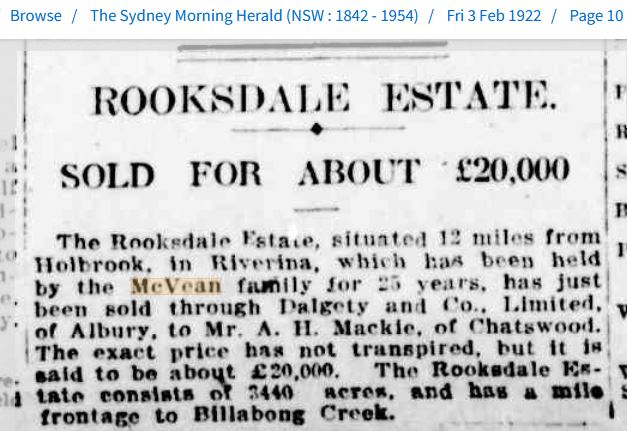
I was told that the estate was situated just outside of Holbrook in the Riverina area of New South Wales. That it had been in the family’s possession for decades, and it had to be put up for sale after my great-grandfather became gravely ill just before he passed away at the age of 46, in 1922.
My cousin, Greg, had this one photo in his mum’s collection of family photos, titled “Photo, Rooksdale Family”, which he shared with me.


Generously shared by Greg P (Cousin)
That is my grandfather, John, seated on the right. Next to him is his sister, Marjorie and next to her is their brother, Alick (Alexander Douglas Macvean).
The back row, from left to right, includes their sister, Jean Isabel, and next to her is a young man whose identity is unknown. Next to him is their other sister, Jessie Agnes, and then the man in uniform, whom I’ve guessed previously, is Maffra William (Jack) Bushby Macvean, their father’s cousin.
Another big assumption I’m making is that they are standing outside the homestead at Rooksdale, the one and only photographic record we have of the place in our family archives.
And yes, even though I was aware of the circumstances, it was still hard to see them confirmed in Daniel’s message that the homestead had been lost in a bush fire in 1952.
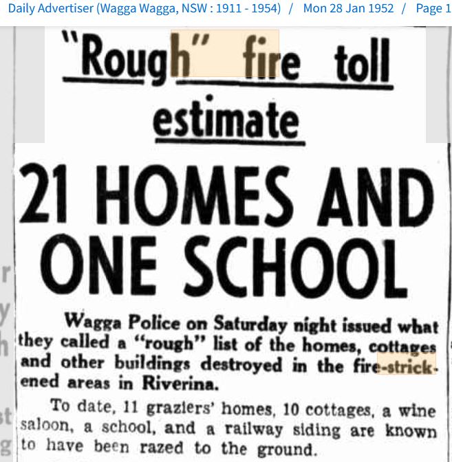
I found the actual newspaper reports of the fire that was responsible for its loss.

Tiled Gallery 2: Courtesy of Trove, National Library of Australia
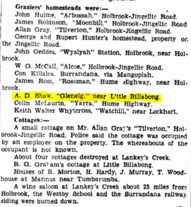
There it is in black and white, “Glenelg”, the old Rooksdale homestead, burnt to the ground on Friday the 25th January, 1952, along with so many others. All that history, gone in one foul swoop.
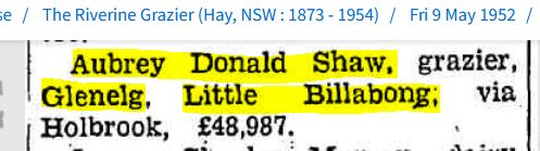
That last tile above is a listing of the estimated cost of the property that Aubrey Shaw lost in the fire. Did you notice the name? Shaw, the same as Daniel’s, I think this means his family has lived there for a very long time. (We will come back to this.)
And here is Aubrey! I managed to find him on Ancestry.com.au, and several trees had this photo of him in their galleries, so thanks to those members for sharing.
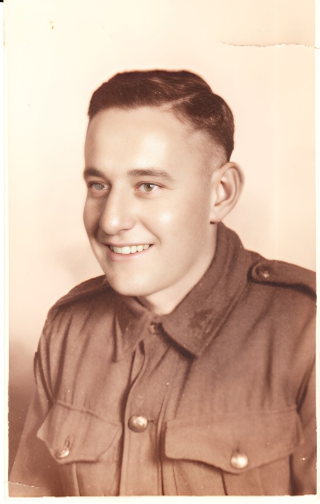
Figure 2a: Courtesy of Ancestry.com.au
Kindly shared by the Riley J Family Tree
Now that I have shared this little bit of background information, back to Daniel’s message. I, of course, emailed him straight back.

This was the article I shared.
Here is the map of the area I mentioned in my response, which I found at the Woolpack Inn Museum, along with a photo of the museum from a family trip back in 2018.
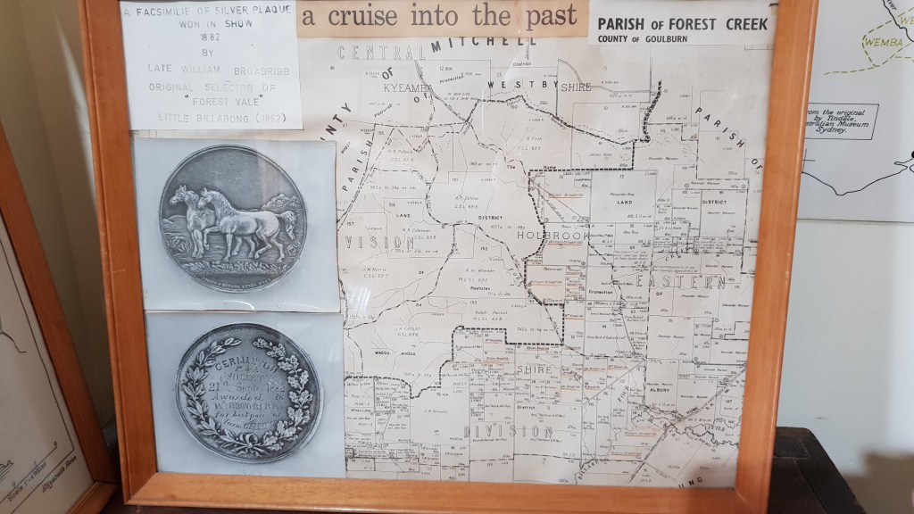


Figure 5: Courtesy of the Macvean Family Archives
Another very generous cousin, named Jim, organised a high-definition scan of the actual map for me. I’ve highlighted the lots that made up Rooksdale.
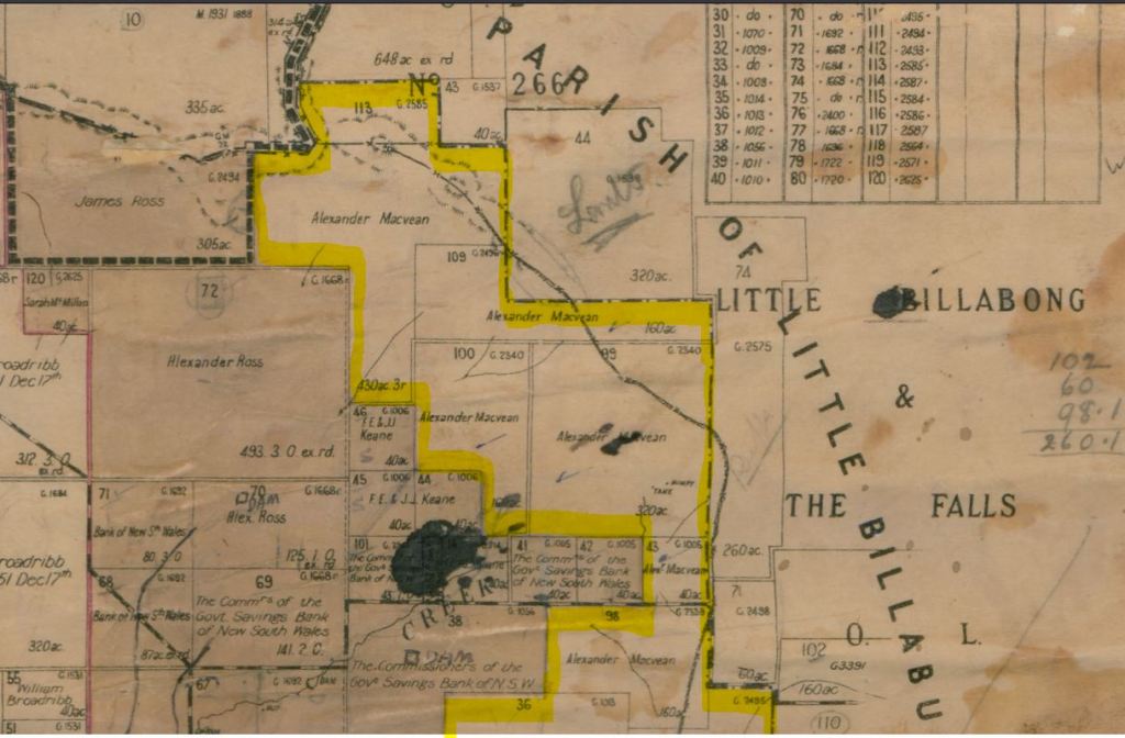

Eastern & Central Divisions N.S.W. 1920
Map 1: Courtesy of the Macvean Family Archives
Jim, like Daniel, just happened to stumble onto the blog one day when surfing the web and also reached out.

Jim’s great-grandmother is my 2x great-grand aunt, Jean Smith Strachan.
Jim very kindly shared a photo of Jean with me.

Figure 6a: Courtesy of the Ross Family Archives, kindly shared by James Ross (Cousin)
It was the death registration of Jean’s mother, my 3x great-grandmother, Christina Russell, that led me to Little Billabong and ultimately to making the connection with Rooksdale.
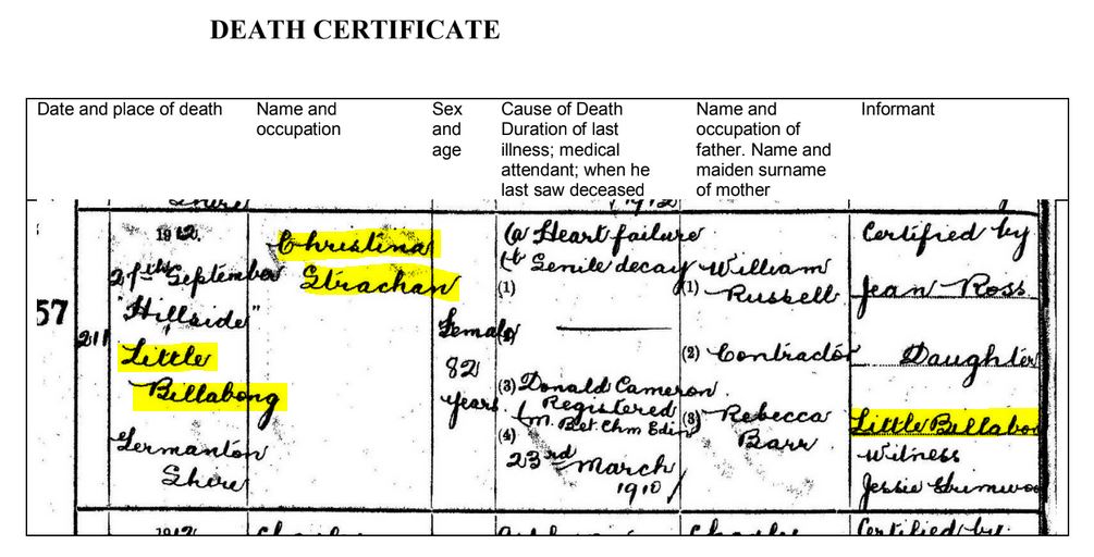
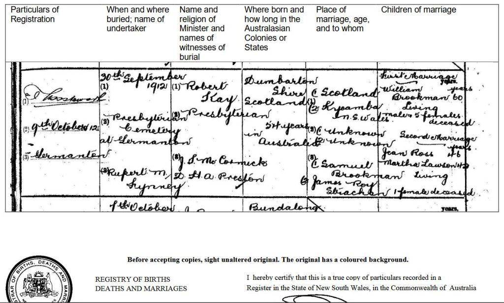
Hillside, the property where Christina passed away, was the key. It was also part of my family lore. I’d grown up knowing that this was the property next door to Rooksdale and owned by the Ross family, another branch of cousins on the family tree.
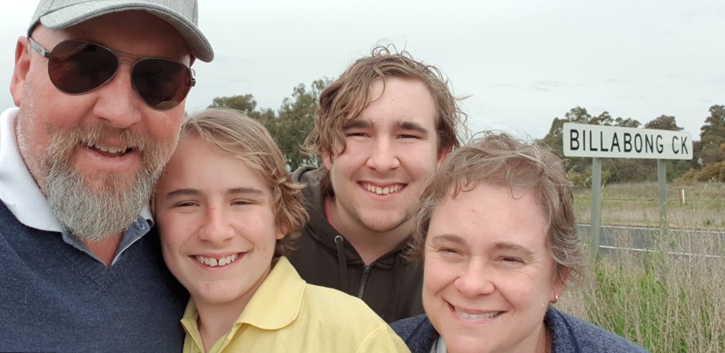
Knowing this connection and seeing the map at the museum enabled Alex, the boys, and me to visit the southern boundary of the estate on our trip in 2018. We headed to where the Little Billabong Creek crosses the freeway. I’ve highlighted the creek crossing below.

Eastern & Central Divisions N.S.W. 1920
Figure 7: Courtesy of the Macvean Family Archives
Luckily, nothing had changed, and the creek still crossed in the same spot. This is the highlighted section on Google Maps from 2022.

Figure 8: Courtesy of Google Maps
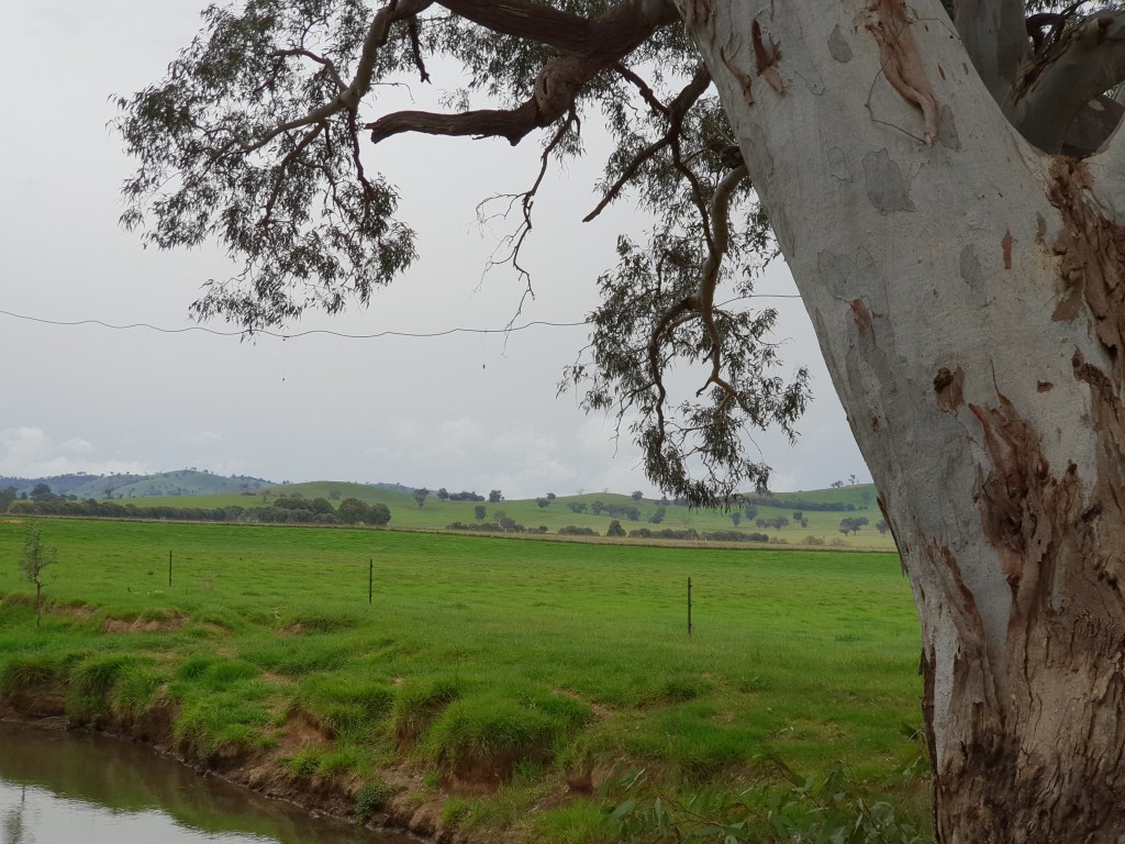
And here is the creek approaching it from Holbrook.

Figure 9: Courtesy of Google Maps
We got out and walked down to the creek and looked west (left) as Jim had indicated in his message, and gazed on what I was hoping used to be my grandfather’s home.


You may have noticed from (Figure 7) the name William Broadribb, he was my great-granduncle, Josiah George Cox’s father-in-law.


Josiah was the brother of my great-grandmother, Agnes Brookman Macvean, née Cox, my grandfather’s mum.
And did you notice Mrs. Jas. Ross, aunt of the bridegroom, in the article? That is Jim’s great-grandmother, Jean Smith Strachan in charge of the church decorations.
The piece of land on which we parked the car and took the photo with the Billabong sign next to us was actually William Broadribb’s land, known as the Forest Vale Estate, as mentioned in the wedding article.
You might have also noticed in (Tiled Gallery 3) the mention that William was the first squatter to “select” this parcel of Wiradjuri land back in 1862. Interestingly, there are no NSW Gazette listings of “Transfer of Runs” available on Trove for 1862, 1863 or 1864. Maybe they haven’t survived, so I am unable to confirm this date.
The church where Emily and Josiah married is long gone, but I was able to find some information about it online. It was actually built on Forest Vale land and sat probably 300 meters from where we were standing for the photo above. The Churches Australia website, where I found the information, even had its position plotted on this map below.

https://www.churchesaustralia.org/list-of-churches/denominations/presbyterian-church-of–australia/directory/10038-little-billabong-presbyterian-church-former
According to Churches Australia, the Little Billabong church was built in 1901 and was opened in October of that year, seven years before Emily and Josiah’s big day. The site amazingly had a photo of the old church taken sometime before it was demolished in the late 1980s.
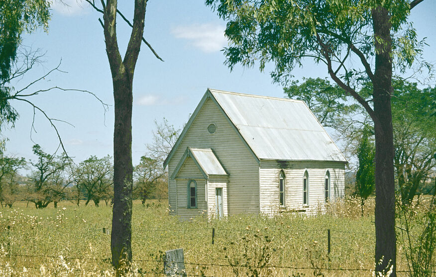
Figure 11: Courtesy of Churches Australia
https://www.churchesaustralia.org/list-of-churches/denominations/presbyterian-church-of–australia/directory/10038-little-billabong-presbyterian-church-former
Forest Vale Homestead, where the sumptuous wedding breakfast was held on that Wednesday morning, the 20th of May, 1908, still stands today. It is remarkable how close it was to the church. (I’ve highlighted the homestead’s position in yellow in the bottom left-hand corner of the map below.)
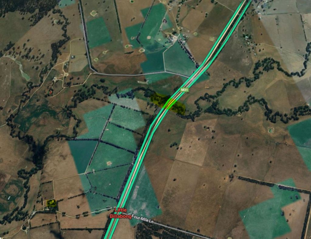
Showing the Forest Vale Homestead
Figure 12: Courtesy of Google Maps
I found the property on Realestate.com.au when it was last listed for sale in 2018. It had some fantastic photos of the estate and the homestead, and I’m sure there are some original features shown here that would have been there on that wedding breakfast morning.


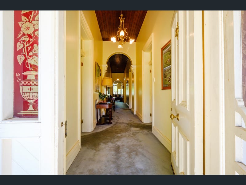

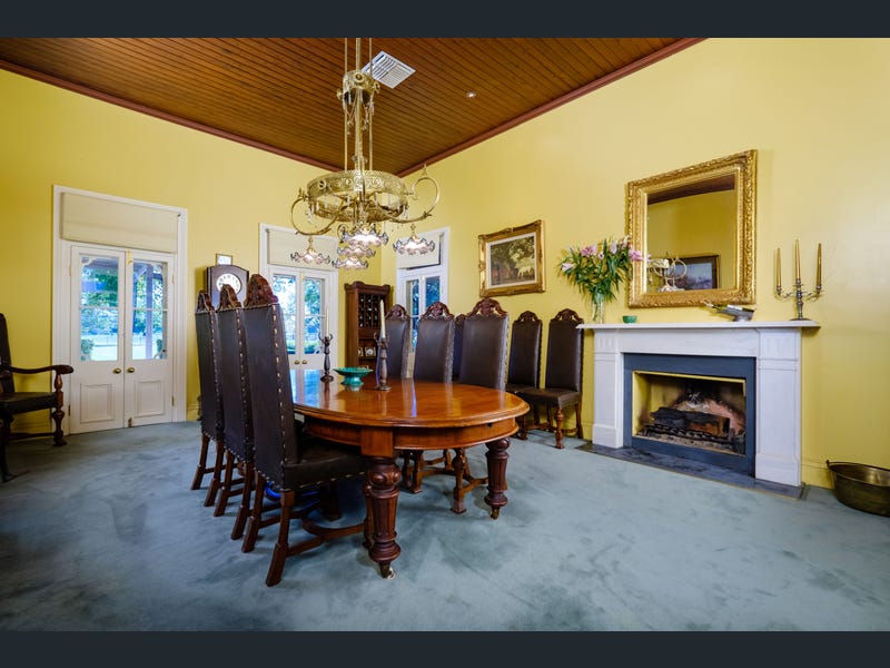

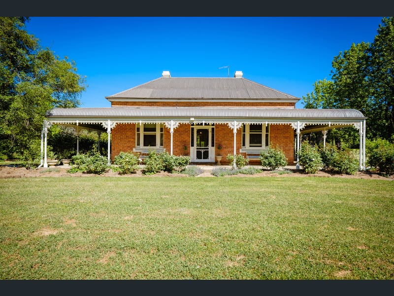
Tiled Gallery 5: Courtesy of Real Estate.com.au
https://www.realestate.com.au/sold/property-mixed+farming-nsw-holbrook-7998390
What an absolute treat to be able to see inside the homestead. Thanks to Real Estate.com.au for still making the photos available.
I was really hoping to find something like this for Rooksdale, that’s before I found out about the fire. This is what makes seeing these photos of Forest Vale so special, knowing that the fires came so close in 1952, and it could have been lost, too, yet it survived.
Forest Vale stood in this very spot at the same time as Rooksdale did somewhere not far from it, and my family walked over that threshold and were within the walls of that building 117 years ago.
In relation to the “…somewhere not far from it…” (as I still didn’t know exactly where the Homestead was on the estate), Daniels’ message gave us a new clue as to its position. He said it was on the eastern side of the highway. I’d always assumed it would have been on the western side with the bulk of the land parcels. There was only one section that was on the eastern side, and this is it.

Eastern & Central Divisions N.S.W. 1920
Figure 13: Courtesy of the Macvean Family Archives
The bottom section of Lot 6. This is on the other side of the creek from where Alex, the boys and I had stopped and taken the photo. This section of land is literally over our shoulders in the photo with the Billabong sign in (Tiled Gallery 4) above.
Could we have been that close and not known it? The answer is yes! Daniel followed up on my message a couple of days later.

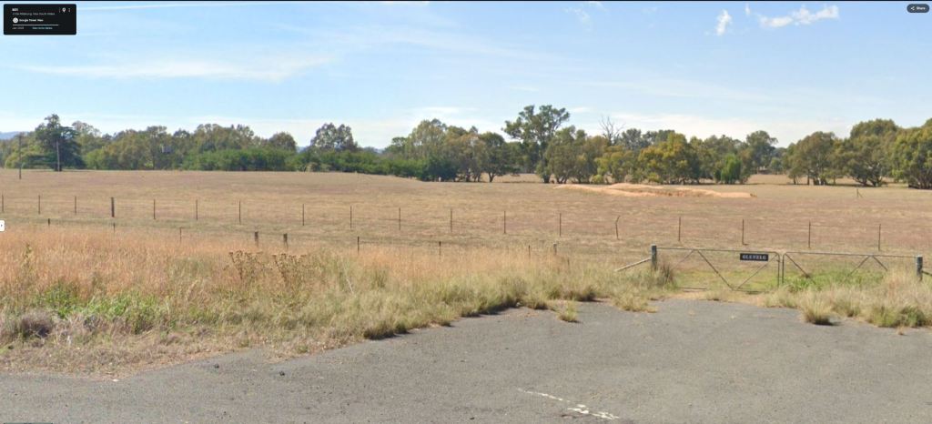
Daniel had gone down to the site to specifically take the photos for me. This was something I had been trying to find out for the last decade or so, where the homestead was, and Daniel confirmed it with one email and some fantastic photos.

Little Billabong, New South Wales, July 2025
Figure 15: Courtesy of Daniel Shaw

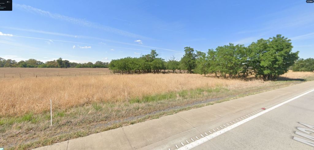
Little Billabong, New South Wales, July 2025
Figure 16: Courtesy of Daniel Shaw
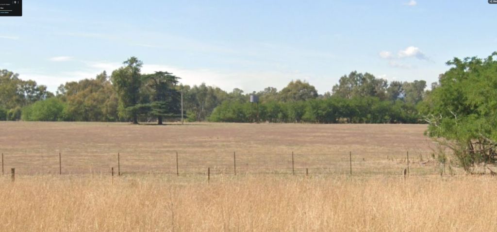
Little Billabong, New South Wales, July 2025
Figure 17: Courtesy of Daniel Shaw

Little Billabong, New South Wales, July 2025
Figure 18: Courtesy of Daniel Shaw
I mean, they are just brilliant! To finally see exactly where my grandfather grew up, where my family lived for over 25 years, is just magic. As I mentioned earlier, what a gift, and all thanks to Daniel!
My Aunty Marj, my Pop’s sister, wrote a history of their time at Rooksdale; unfortunately, it is lost to us at the moment, but I’m hoping one day it will turn up. I do, however, have two pages from it in my digital archive somewhere, which I just can’t find at the moment. (So frustrating!!) But I do recall her writing that the homestead had rows of trees on either side of the drive from the main Sydney road up to the house. Looking at those two trees in (Figure 16), I wonder if they are the last surviving remnants of those driveway sentinels.
I can imagine them so easily now, too, thanks to the photos of Forest Vale that Real Estate.com.au shared. This was its driveway back in 2018.
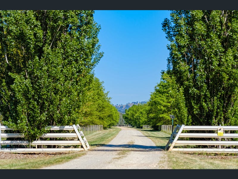
Figure 19: Courtesy of Real Estate.com.au
https://www.realestate.com.au/sold/property-mixed+farming-nsw-holbrook-7998390
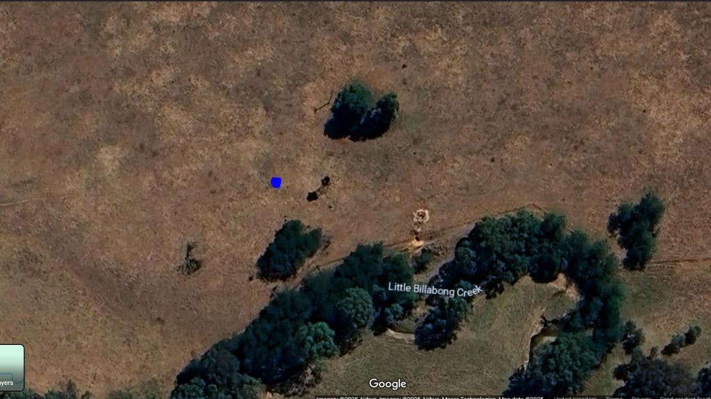
Daniel also very kindly marked exactly where on that eastern section of Lot 6 the homestead sat.
This allowed me to find it on Google Maps. I’ve marked the position of the homestead with a blue dot.

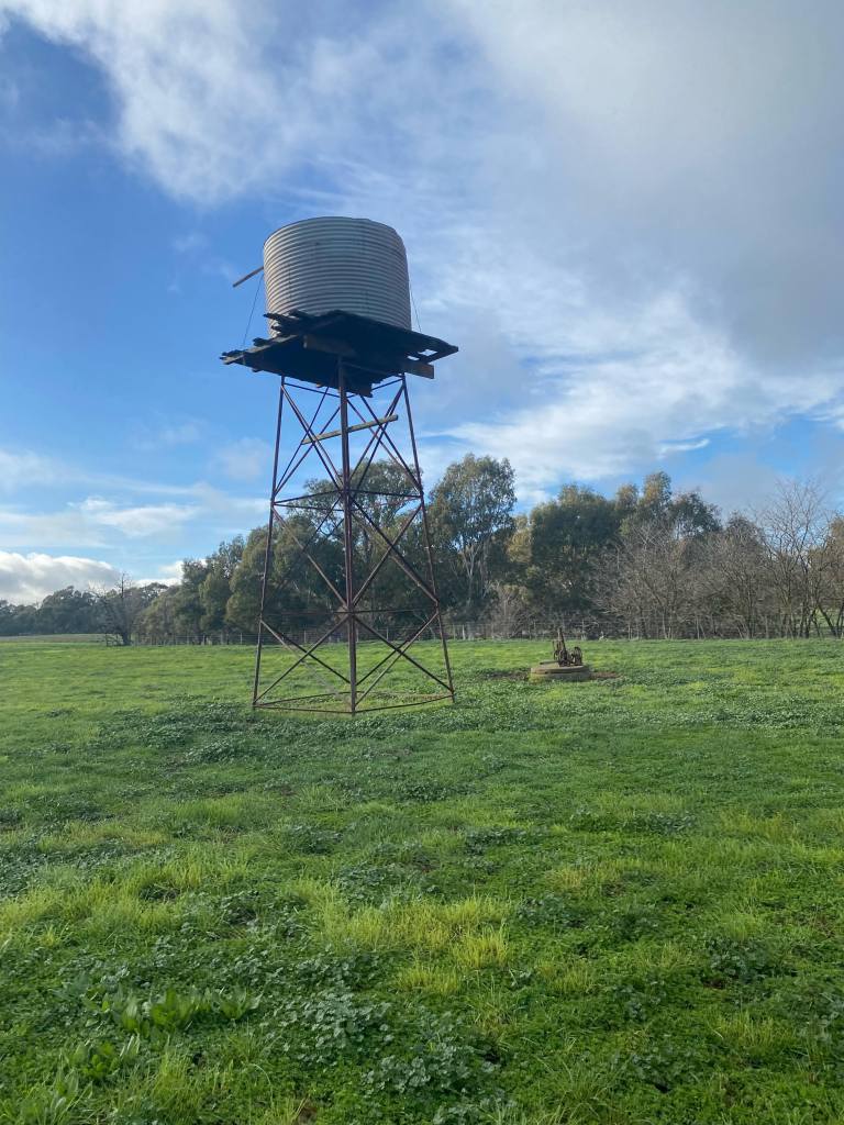
I’m assuming this is it, as you can see the shadow of the tank stand there in the middle of the next shot, and I’m sure that would have been close to the house.
This next shot is looking at it from the highway, from the vantage point of where the M31 note appears on the Hume Highway in (Figure 21).
I’m just hypothesising here, but I wonder if this stretch of trees below might be the remnants of the original driveway trees? There looks to be a couple of older specimens in the middle of the photo.
When you zoom in, they look like they line up with the two sentinels from Daniel’s photos.
I know I have used this description a few times already, but what a gift to now know exactly where my grandfather’s home was, after all these years. I must say, though, my interest wasn’t just focused on my family’s time there; I have also been very interested in the history of the estate as well.
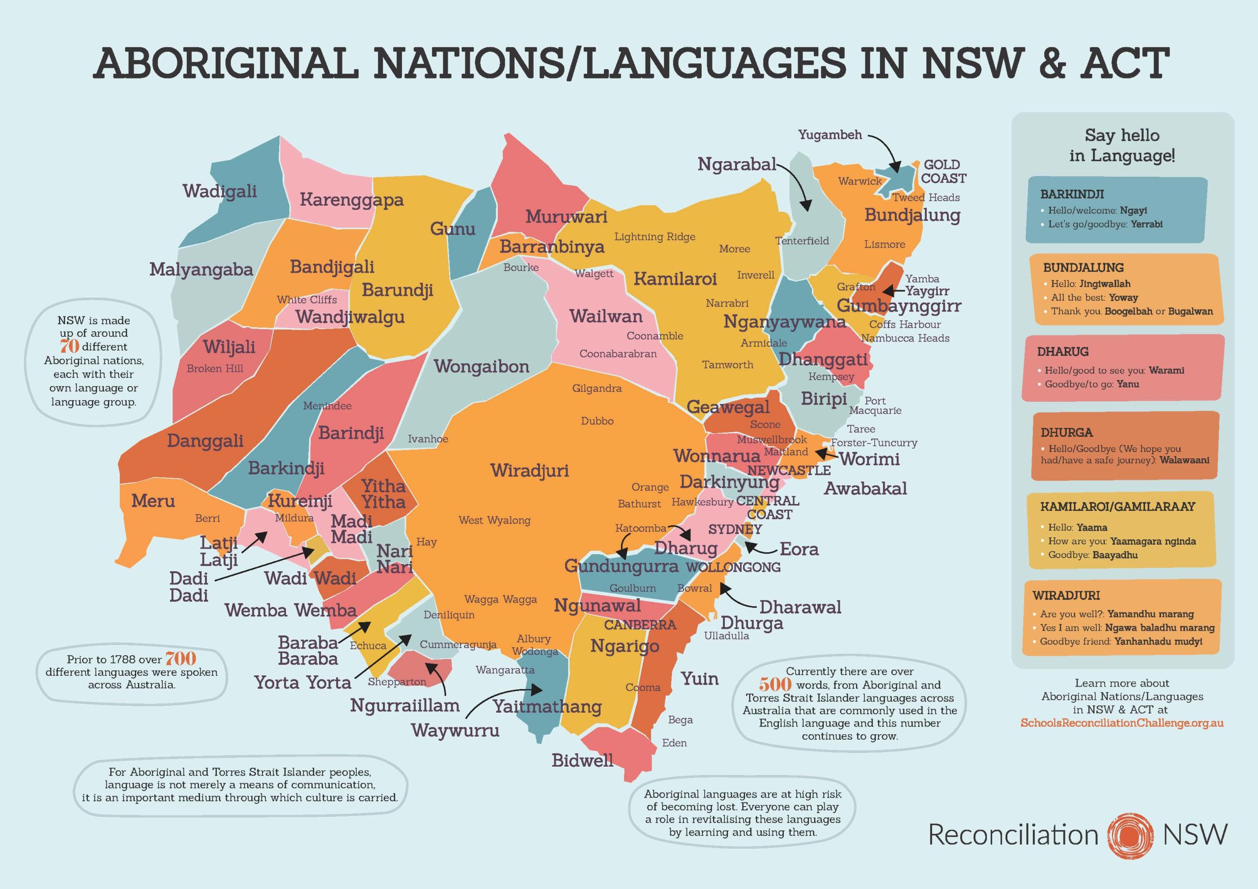
The Macvean’s tenure of the land for 25 years is just a blip in the history of the site. The estate, which is roughly situated between Wagga Wagga and Albury, is actually part of the traditional lands of the Wiradjuri people.

Figure 26: Courtesy of Reconciliation New South Wales
https://reconciliationnsw.org.au/wp-content/uploads/2024/01/NSWRC-language-map-update-A3-text-boxes-2022-web-scaled.jpg
European occupation occurred from the time that the explorers, Hamilton Hume and William Hovell, walked into the area in November 1824. It took another 24 years before settlement began in the Little Billabong area when Thomas Mitchell established the first run at the base of the Lunts Sugarloaf in 1848. https://culturallandscapesandroutesnsc.wordpress.com/wp-content/uploads/2018/02/hume-highway-northern-final.pdf

https://www.exploroz.com/places/21646/nsw+lunts-sugarloaf
In an amazing piece of luck, I found the original newspaper notice of Mitchell’s possession of this particular section of Wiradjuri country.

17280 acres! Wow! That is enormous, and I can only assume it would have taken in the land that would eventually be known as Rooksdale.
In order to try to discover the actual history of Rooksdale, I decided to work backwards from what I knew. I knew my family took possession of the estate sometime in 1895. I jumped onto Trove and found what I’m presuming would have been one of the for-sale notices my family would have read.

What was interesting about this advert was the fact that it listed that there were two residences on the estate. This fits with some of the information I had uncovered, mentioning that other people were living there at the same time as my family, such as this next example.
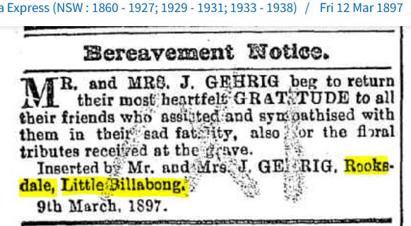
I managed to find a small article describing what the sad fatality was and it looks like my great-grandfather, Alex, was involved.

How terrible, not to be able to save the children, and that description of how they died, you can only hope the family never read that.
I found the Gehrig Family on Ancestry.com.au, and it was actually Amelia (3) Stanley (2) and Hilda (1) who lost their lives that day. Their parents were Jacob and Mary Gehrig.
One of the family trees on Ancestry.com.au had a photo of Jacob and Mary with their remaining children taken sometime in the early 1910s.
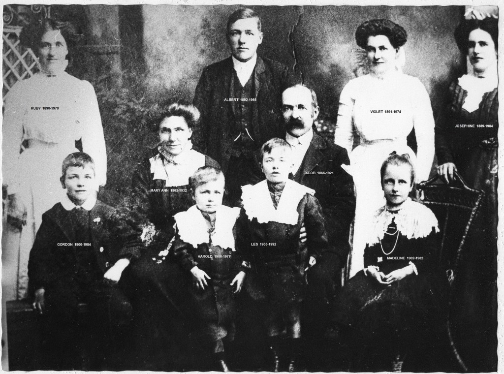
Figure 31: Courtesy of Ancestry.com.au from the Simsearch Family Tree
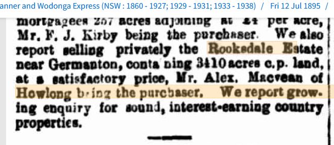
Two months after the advertisement in (Figure 28) appeared, the sale was closed, and as the next article confirms, it was my 2x great-grandfather who actually purchased Rooksdale.


Figure 33: Courtesy of the Macvean Family Archives, Generously shared by Sally M (Cousin)
My thinking is that my great-grandfather, Alex, was likely appointed as the manager of the estate. Then ownership was probably transferred to him upon his marriage to my great-grandmother, Agnes or Annie, as she was known.
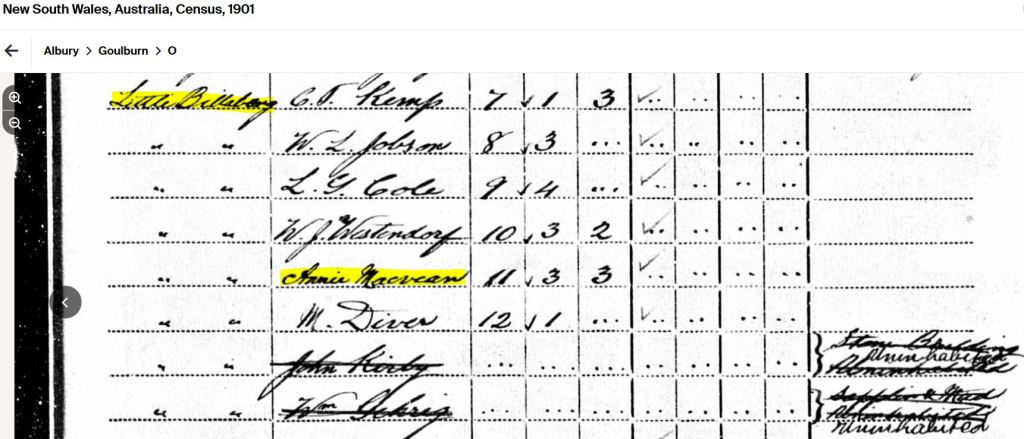
This Census listing is quite telling; there is William Gehrig’s name crossed out, and the residence he and the family were living in is listed as uninhabited.
I am so lucky, I have a couple of photos of Alex and one of Annie. The photo of Alex was taken in 1904 when he was on the Germanton Pastoral Agricultural and Horticultural Society Committee. The photo of Annie, although undated, is likely to have been taken sometime in the late 1920s.
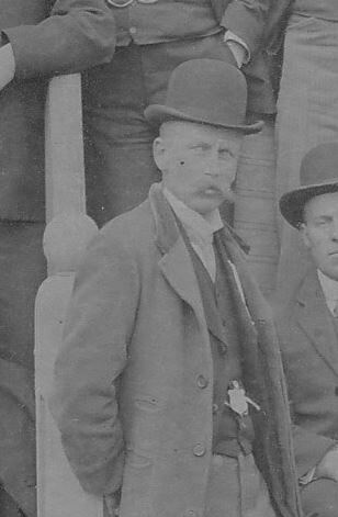
Figure 34a: Courtesy of the Macvean Family Archives

Figure 35: Courtesy of the Macvean Family Archives
Another point of interest in the Census listing above is that it indicates there were 3 males and 3 females living on the estate at the time. My two great-grand-aunts, Jessie and Jean, had been born by then, but neither my grandfather nor his brother, Alick, had been born. I wonder if one of the other males might have been Josiah George Cox, Annie’s brother. (My reasoning for this is coming up.)
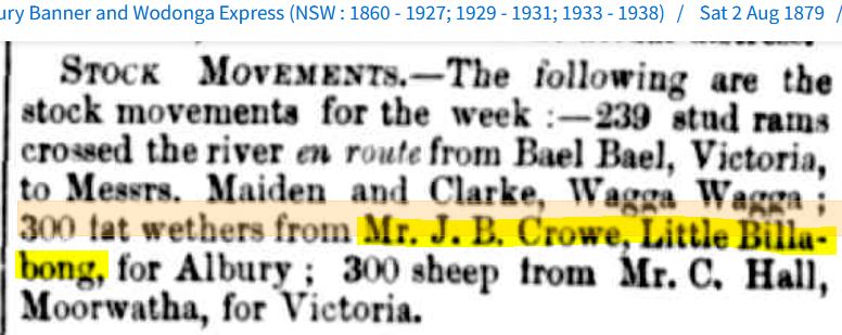
I can’t find any mention of Josiah anywhere at the time; mind you, he was only 21 years of age, so not that unusual. This is the earliest appearance he makes in the press, three years after the census.

I can’t imagine my great-grandparents entrusting Josiah with moving all those sheep from Little Billabong to Yerong without him having a few years of experience up his sleeve. So I’m thinking that he could have been in the area for several years prior, thus appearing in the 1901 census with Annie and Alex.
Oh, I do love this next type of find. In my search for information on Josiah, a photo turned up for him from 1911, taken seven years after the stock-movement job. Meet my great-grand-uncle, Josiah George Cox.

Figure 37: Courtesy of Trove, National Library of Australia
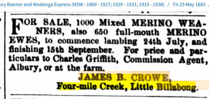
Keeping with the theme of working backwards, if we take a step back from the for-sale notice in 1895, we find an earlier version from May 1891. This version mentions the previous owner’s name.


Mr James Crowe and I have a feeling, from this next article, that James was in the same position as my great-grandfather, having to put the estate on the market because of health issues.
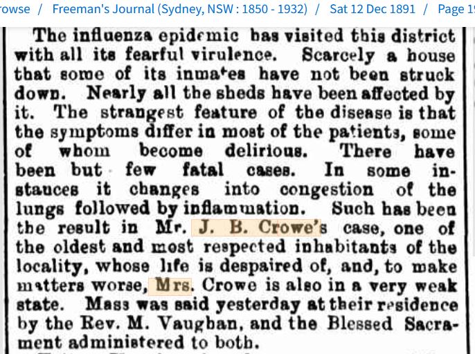
Having just done a bit of background reading on James, I just worked out that this notice above was actually printed the day before James passed away.

I found another death notice, printed a week earlier, that very conveniently mentioned how long James had been in the area.
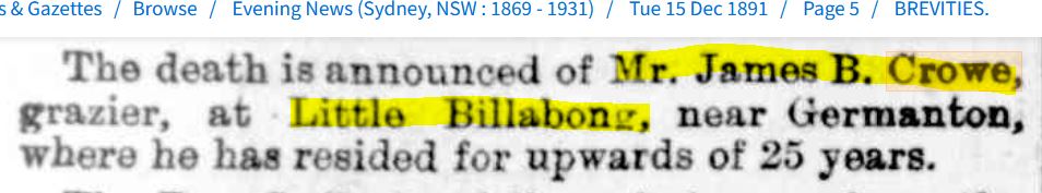
This means James was potentially settling on Rooksdale or, at the very least, in the locality, somewhere in the mid-1860s.
After hours of trawling through Trove, this is the earliest mention I can find of James in the area, dating back to 1868, which fits nicely with what we already know.

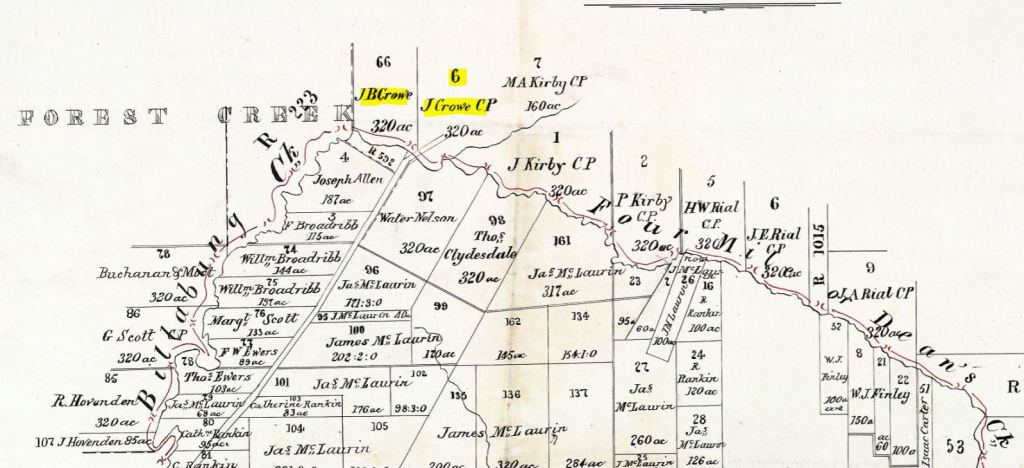
Now, Four Mile Creek is the Creek that runs the boundary of the Rooksdale homestead lot, Lot 6. Here is a close-up of that section of the Lands Registry map from 1892, and check out whose name appears above and next to my great-grandfather’s name, crossed out.
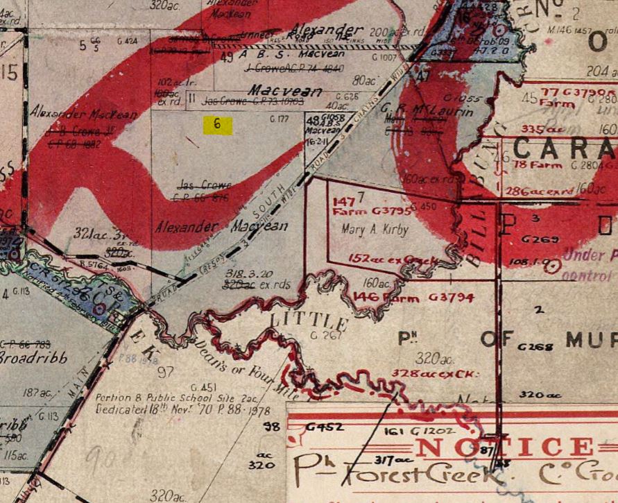
Taken from Parish of Forest Creek, County of Goulburn, Map 1892
Figure 42: Courtesy of the NSW Land Registry Service
https://hlrv.nswlrs.com.au/
James Crowe! How is that? I love it when information like this appears. Now, I wanted to mention here that I think this gives us a good indication that at this early stage, James was referring to the estate as Four Mile Creek and not Rooksdale as yet. But I think I might be wrong.
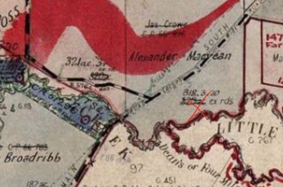
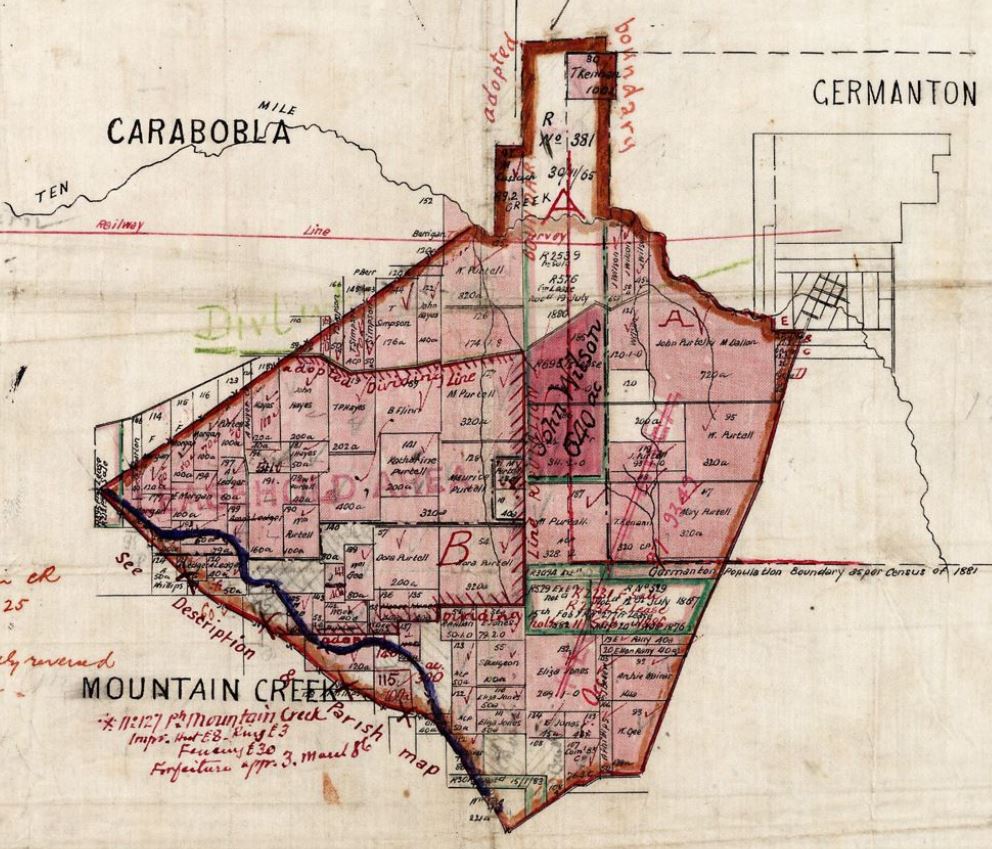
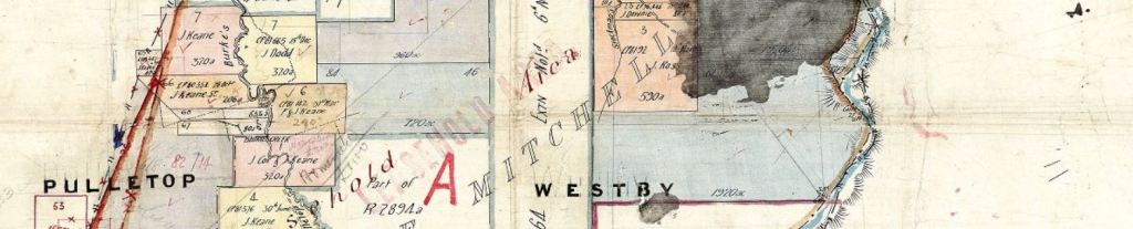
I just found a map on the Land Registry Service site that shows that there was indeed a station run known as “Four Mile Creek”, but this amazing map confirms that it was actually three lots over to the East of the Rooksdale estate.

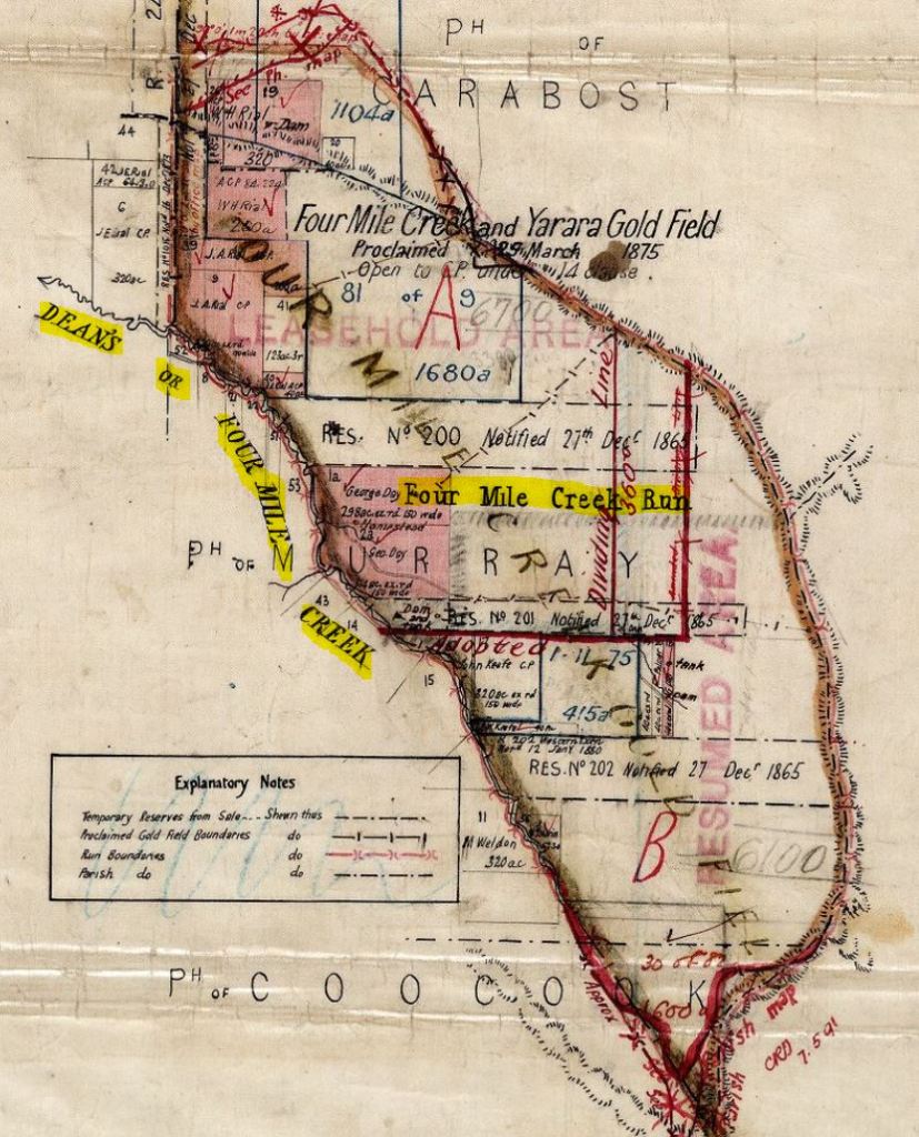
Map 2: Courtesy of the New South Wales Land Registry Service
https://hlrv.nswlrs.com.au/
Here it is marked in red below, for comparison on the next parish map over from Forest Creek. Rooksdale Homestead is situated roughly at the base of the second T in LITTLE, under FOREST on the left. I’ve also highlighted Lots 44 and 6 that correspond with those above, so it is easy to place.

Showing Boundary of “Four Mile Creek Run”
Figure 42a: Courtesy of New South Wales Land Registry Service
https://hlrv.nswlrs.com.au/
After spending the last couple of days diving into anything I could find on Trove and Google mentioning the area, I think it is more likely that James is referring to the general area he is living in, as Four Mile Creek and not specifically the name of the estate.
Before the name of Germanton was gazetted in 1876, the Holbrook area was known by a number of different names, “Friday Mount”, “Camden Forest”, “Therry’s”, “Billabong” and even “Ten Mile Creek”. https://www.greaterhume.nsw.gov.au/GHTownVill/Holbrook
I so hope this is not the last time we can be certain about who has ownership of the Rooksdale estate.
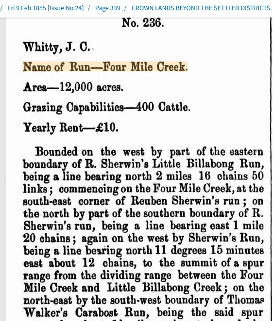
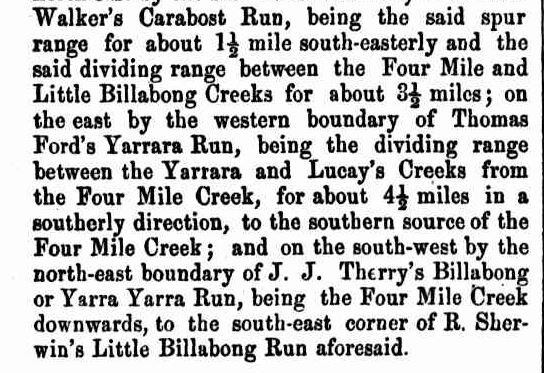
What I can be certain about, when the Crowe’s tenure started. I found the article that mentions when James actually selects the estate or part of it. I know, incredible!
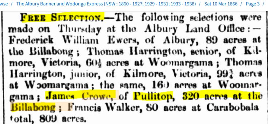
This, of course, is not the full estate of 3410 acres (…more or less…) that James’ estate sells to my 2x great-grandfather in 1895. This was more likely than not, the purchase of Lot 6, where the Rooksdale homestead sat.
I then managed to find an obituary for James, and it gives us a bit more insight into James’s history and his connection to the area.

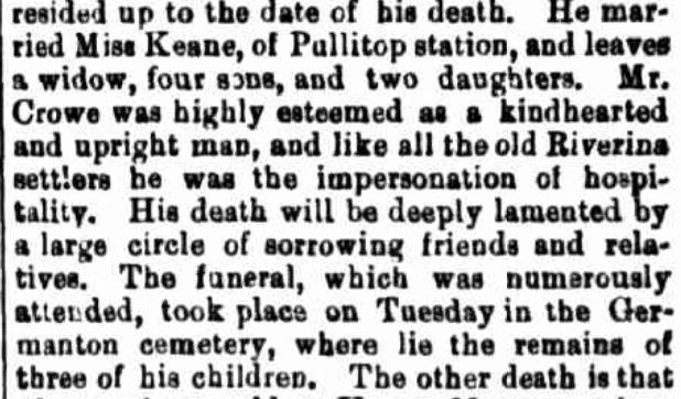
There is that 25-year time period basically confirmed for us from another source, and this obituary suggests that it was indeed only the Rooksdale estate that James and Miss Keane (Bridget) settled on.
Next, I managed to find a notice of Bridget and James’s marriage from 1857.

Pullitop was the name of the run that Bridget’s parents (Hannah and John Keane) owned at Burke’s Creek, which is only 21 km north of Rooksdale.

If we look back at (Figure 43), we can see it notes that James is from Pullitop, so I think it is safe to assume that he and Bridget were living with her family before making the selection of land in 1866.
The National Library had two photos of Pullitop Station in its collection. The first mind you is 28 years after Bridget and James’ wedding, and the second, 40 years after. But still, what a great opportunity to see the actual place they were married.

Figure 45: Courtesy of the National Library of Australia
http://nla.gov.au/nla.obj-149343528
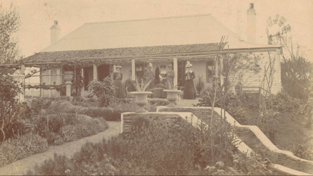
Figure 46: Courtesy of the National Library of Australia
http://nla.gov.au/nla.obj-149345015
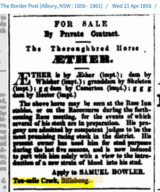
This next phenomenal article is our first mention of James and the family potentially being on Rooksdale, printed just three years after James had made his selection of the property. I know it doesn’t say Rooksdale, but we are so close with “Billabong”. It is a testimonial on the benefits of using a water diving service offered at the time.
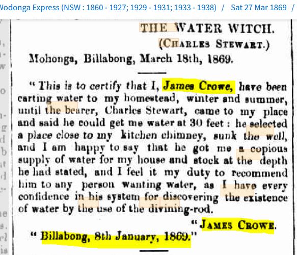
This is an amazing find when you think of the photo that Daniel shared with me of the well and the pump from Rooksdale.
This is probably the very spot that Charles Stewart selected 156 years ago.

Figure 48: Courtesy of Daniel Shaw
James wasn’t the only one to take up Charles’s water divining service, one of his close neighbours did too.

Alexander Ross is Jim’s (who shared (Map 1) with me above), 2x great-grandfather. You will notice Alexander and his sons, John and Alex, names written on the map as well.
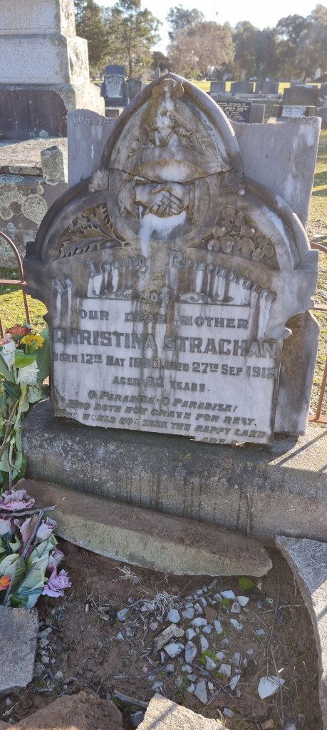
I don’t have a photo of Alexander, but I did find his and his wife, Janet’s, grave site not far from my 3x great-grandmother, Christina Strachan, in the Holbrook Cemetery. We visited the cemetery in 2023 and got to take photos of their headstones.

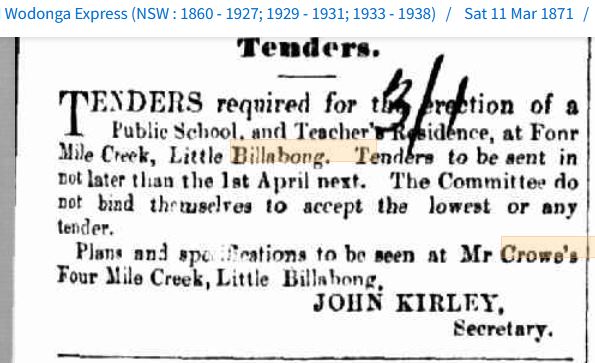
The next mention that James has is just three months later, when he is elected to the Little Billabong School Construction Committee.
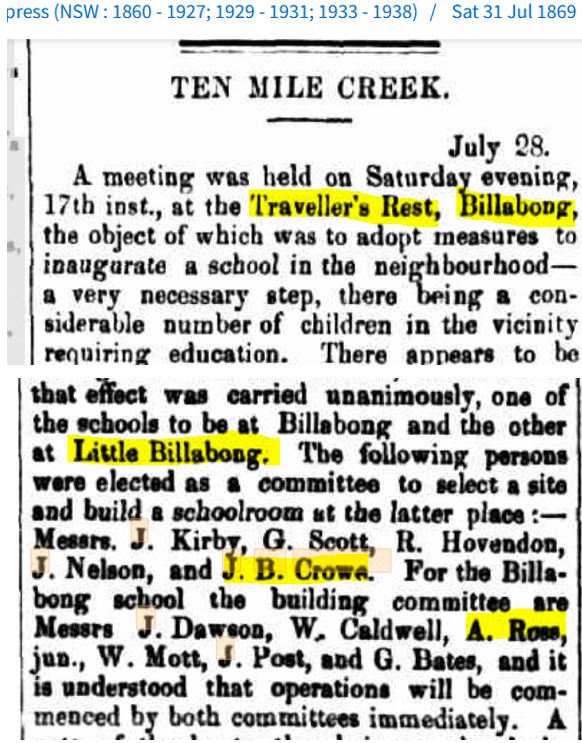
If you look back at (Figure 42), you will see the site for the school the committee agreed on is marked on Lot 97, the next lot over from the Rooksdale Homestead. In fact, I had been aware of this story for a while, about the school being very close to Little Billabong Creek.
This was the school that my grandfather, John, and his siblings attended, and it survived on this site for decades after the school shut down. The local historical society saved the building and had it rebuilt on their premises.
We got to see it on that same visit back in 2018.
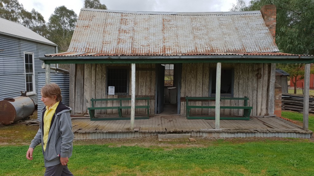
Figure 50a: Courtesy of the Macvean Family Archives
Before we get back to James, Bridget and Rooksdale, there is one other family link in the article above (Figure 50).
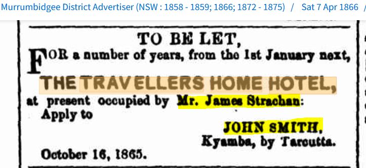
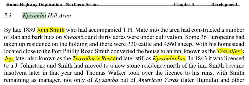
“The Travellers’ Rest, Billabong”, where James Crowe attended the meeting about the school, is actually where my 3x great-grandmother, Christina Strachan, (who was Mrs Brookman at the time) worked as the housekeeper in the mid-1860s. The owner of the Inn, who advertised for a housekeeper in early 1863, was Mr John Smith, and the landlord of the Inn was a Mr James Strachan.
I am only aware of these details thanks to a letter that John Smith wrote in 1868 and sent to the Empire Newspaper, where it was published. In the letter, he describes an incident where Christina’s son, William Brookman, my 2x great-granduncle, was charged with bush-ranging and sentenced to death at the age of 16. (Oh yeah, it’s insane, and a whole other story for another post.) Here is a section of the letter below.

I went over to Ancestry.com.au, not really expecting to find anything, but, remarkably, I found Mr John Smith there, and one of the trees had a photo of John available. Here is the author of the letter above and my 3x great-grandmother’s employer from 1863.

Figure 50b1: Courtesy of Ancestry.com.au
Kindly shared by user: jaeespey
Sue Rosen & Associates, in their Heritage, Assessment, and History Report for the area, published in October 2006, confirmed Smith’s link to the property and noted that the Inn was known by several different names. https://share.google/Oci7ryWN4ZcQHdIDt
https://share.google/Oci7ryWN4ZcQHdIDt
And you won’t believe this, but while compiling this information, I discovered another connection to the family. So, James Strachan, Christina’s second husband, well, his sister, Jane Strachan, married John Smith’s brother George in January of 1858.
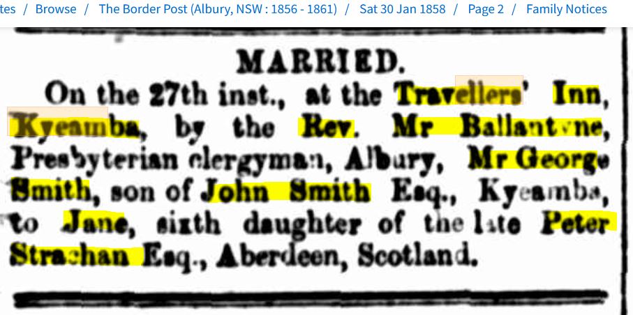
The Reverend Mr Ballantyne from Albury, whose full name is David Hunter Ballantyne, is actually my great-grandfather, Alexander Ballantyne Smith Macvean’s (and the eventual owner of Rooksdale) grandfather. This is 5 years before Alexander’s future wife’s grandmother becomes the housekeeper of the Inn. How is that for small world, six degrees of separation stuff?
And here is the final kicker, the Inn is still standing today, 150 odd years later. Alex and I found it on our last Riverina trip back in 2023. It is a private home now but we managed to get some photos of it.

Figure 50d: Courtesy of the Macvean Family Archives
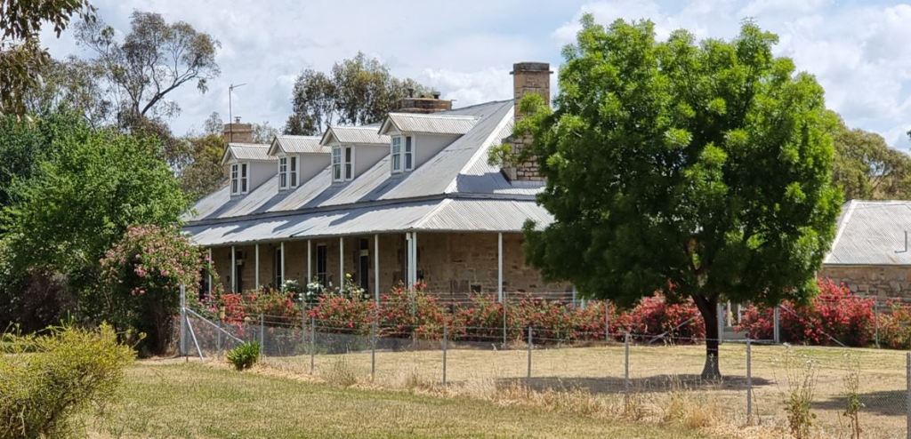
Figure 50e: Courtesy of the Macvean Family Archives
So after that little detour, back to James and Bridget Crowe. We can now confirm, thanks to those articles we have uncovered so far, that they were living on Rooksdale from 1866 to 1891, when James passed away. The following is a selection of some of their life events reported in the press over the years that I managed to uncover.


Tiled Gallery 6: Courtesy of Trove, National Library of Australia
Did you notice that second tile to the right above? It shows another chunk of the estate coming into Bridget and James’s possession. Another 960 acres of land that presumably made up part of Rooksdale.
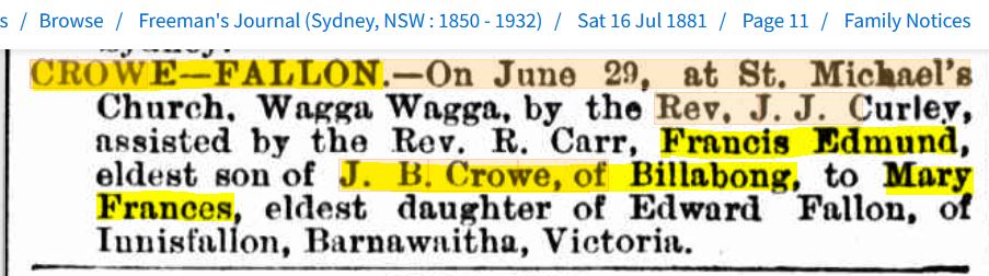
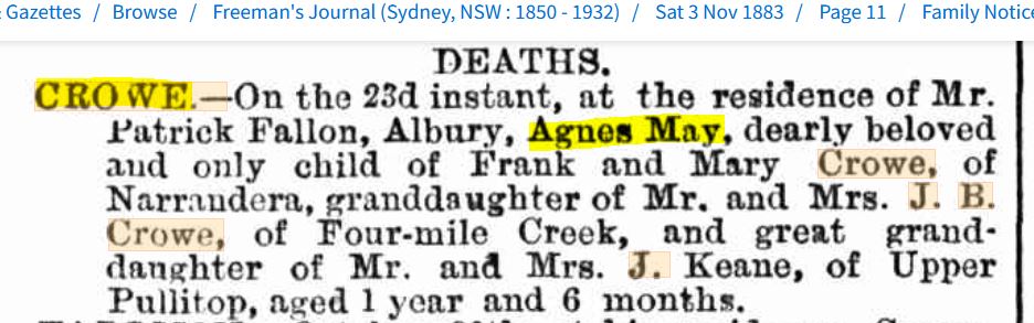
Next, we have our very first mention of the Rooksdale name in print. And unfortunately, it is in connection with the death announcement for Bridget and James’s son, Francis Edmund Crowe.

Then another Rooksdale mention, two years later. This time, for a wedding article for Francis’s brother, James Bernard Crowe Jnr, when he married Lizzie Serong.

This brings us full circle back to James’s death in December 1891.

Don’t forget, Rooksdale had already been on the market for seven months by this stage, as we discovered in (Article 2) above. And that is where it stayed until mid-1895, when my grandfather’s grandfather purchased it for my great-grandfather. You know I loved typing that, right?
In the meantime, life went on for the Crowe family at Rooksdale without James Snr.
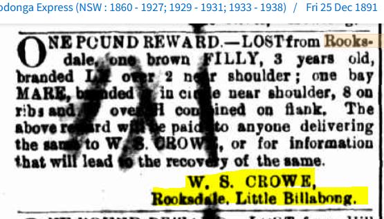
This is Bridget and James’s son, Willie Crowe, advertising above.

I think this advert above might be for a tutor for Bridget’s grandchildren, Adeline and Arthur, both aged about 8 years old at the time. They are the children of Bridget and James’s son, Michael and his wife, Ellen Franklin. My reasoning for this is that they are the only grandchildren old enough at the time to need tutoring. Perhaps Michael and Ellen moved in to help Bridget after James passed away.
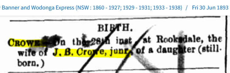
These next notices confirm exactly who was living and dying at Rooksdale with Bridget at the time: her son, James Bernard Crowe Jnr, and his wife, Eliza Jane (Lizzie) Serong.


What an absolute tragedy for the family, and only 18 months after James Snr’s passing. I imagine it would have been an especially tough time because not only did James Jnr lose his wife, Lizzie, during childbirth, but also their baby daughter, Mary, who was stillborn.
Thanks to an Ancestry.com.au user, I found them all buried together, with James Snr, as well as three of his and Bridget’s children, who they lost in infancy.
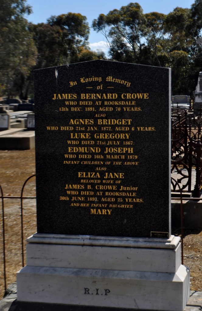
Figure 59: Courtesy of Ancestry.com.au, Kindly shared by User: sweetwhitedove1
My next discovery was this phenomenal article describing a visit of a correspondent from the Wagga Wagga Advertiser to Rooksdale, just 12 months on from all the tragedy above.


Article 4: Courtesy of Trove, National Library of Australia
What a fantastic find! Rooksdale described in all its picturesque glory, and I swear I hadn’t read this before describing the trees as sentinels. This visit was just eight months before the Macveans moved in.
What is so poignant about this article above is that tragedy hadn’t left the family alone; it had just struck them once again, a week or so before the correspondent’s visit.
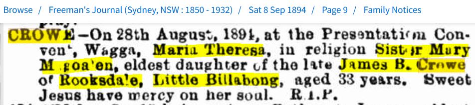
Sister Mary Magdalen, Maria Theresa, was Bridget and James’s eldest daughter, born in 1861. How hard it must have been for Bridget to talk about her niece being in the convent at Wagga Wagga when her daughter had just died there.
The next mention of the family is an article from February of the following year, confirming that Paul Crowe (…the Squire…) was indeed living on the estate.

And next, our final mentions of the Crowes and Rooksdale.
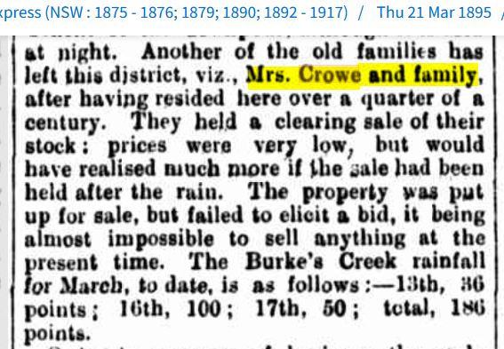
After 29 years, the Crowes have departed, and four months after that, my family’s tenure of the estate is reported in the Express.
What a story so far, and it is only what I have been lucky enough to unearth. Imagine if we had access to original correspondence or testimony from those involved at the time that still survived. I know the story is so much more than what we have at the moment, but unfortunately, it will probably remain lost in time. Don’t get me wrong, I’m not ungrateful, just wishful.
Now we haven’t quite finished with the origin story of the estate yet. I was keen to see if I could trace it back from the Crowes in 1866 to Thomas Mitchell in 1848, mentioned in (Figure 27a).
With most of those different names for Germanton being used at the time, what an absolute mess I got into trying to figure out who had the land in their possession. Here is just a small example of what I found.


Tiled Gallery 7: Courtesy of Trove, National Library of Australia
I did think that was it, and we wouldn’t be able to take the history of the estate any further back. But then I had the thought about going back to the Land Registry Services site to see if I could find any other pastoral runs that might shed some light on who had ownership.
The first one I tried, “Ten Mile Creek Run”, was no good to us; it sits way too low past the township of Germanton.

Map 3: Courtesy of the New South Wales Land Registry Service
https://hlrv.nswlrs.com.au/
The next one, “Little Billabong and The Falls Run”, well, we are getting closer. You can see this one butts up to Rooksdale and over the top of the Four Mile Creek Run (Map 2 ). The blank yellow highlighted square on the bottom left is the homestead position at the bottom of Lot 6.

Map 4: Courtesy of the New South Wales Land Registry Service
https://hlrv.nswlrs.com.au/
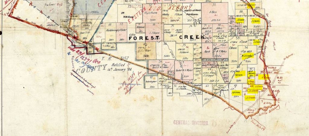
Next, I found “Hillside”, Alexander Ross and his family’s run, and we know that it sits next to Rooksdale, well, actually on the map, above it. Rooksdale sits where the 3700a is printed on the map below.

Map 5: Courtesy of the New South Wales Land Registry Service
https://hlrv.nswlrs.com.au/
I then tried “Yarra Yarra Run”, which is mentioned above as belonging to Mr J.J. Therry, and this one sits below Rooksdale and next to Four Mile Creek Run. So close but not quite there. There is Lot 6, once again.
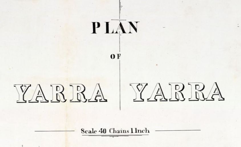
Map 6: Courtesy of the New South Wales Land Registry Service
https://hlrv.nswlrs.com.au/
But then I remembered that I had come across a mention for James Crowe, listing that he had unclaimed letters at the Sydney GPO. I know, random, right? But stick with me.

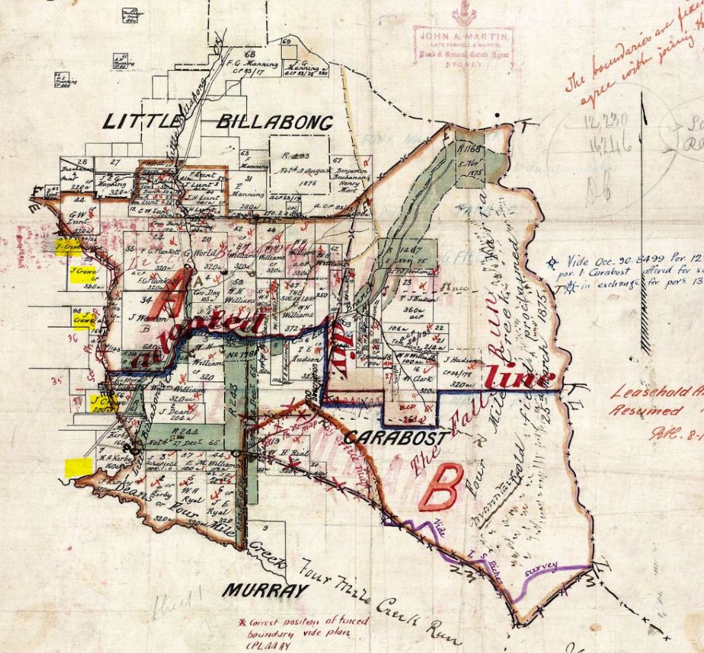
I don’t know what it was, but Bourke’s Creek just stuck. I know it is where Bridget’s parents’ property Pullitop was situated, but I wondered if maybe there was a Bourke’s Creek Pastoral Run, and of course, there was! Check this out.

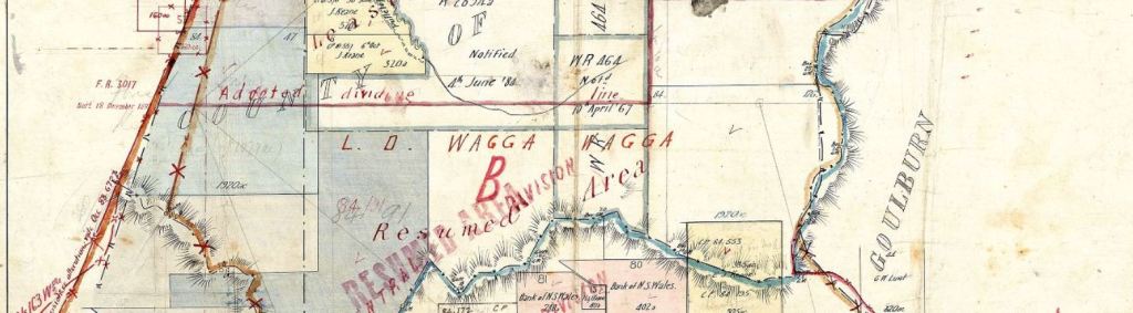
Map 7: Courtesy of the New South Wales Land Registry Service
https://hlrv.nswlrs.com.au/
Here is a close-up of that last section so you can see what I have highlighted. Rooksdale!

Map 8: Courtesy of the New South Wales Land Registry Service
How fantastic is that? We can now confirm that the land that becomes known as Rooksdale was originally part of the “Bourke’s Creek Run”, and check out those other names listed around James’s. “F.E. Crowe” and “M.J. Crowe” are his and Bridget’s sons, Francis and Michael and look at all the “Keanes” that appear. They are Bridget’s brothers, Frances Edmund Keane and John Joseph Keane. I’m assuming the other Keanes are relatives, too.
With all those Keanes appearing there, I thought I would give the name a search with Bourke’s Creek in the mix and look what appeared from February 1867, a Transfer of Runs listing in the Government Gazette.
Wow! How incredible! This Gazette listing confirms that it was Bridget’s father, John Keane and his business partner, John Cox, who had the lease of Bourke’s Creek Run sometime before 1867. Then in February 1867, they split professionally and John Cox took over the Pullitop lease and John Keane the Bourke’s Creek lease.
I did manage to find one earlier mention of John Keane and Bourke’s Creek from 1863.
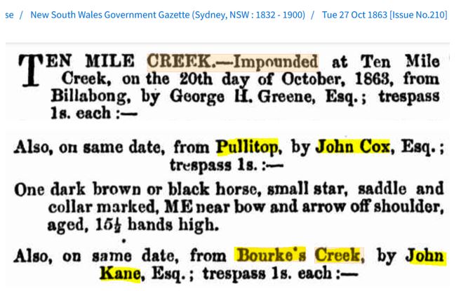
So it could be as early as 1863 that John Keane (Kane) had possession of Bourke’s Creek. We just can’t say it with any certainty as this Gazette listing doesn’t specifically say Bourke’s Creek Run, but still I think that is pretty good to get this close.
Then that is it. There are no earlier mentions of Bourke’s Creek linked with the Keanes or any other name. I have searched every variation of the spelling of Bourke’s Creek on both the Trove site and Google. So I think we can now say with some confidence that we can track the history of Rooksdale from the original owners right up to when my family took possession.
The Wiradjuri People, who are the traditional owners and always will be, John Keane and John Cox, then John and Hannah Keane, James and Bridget Crowe, Alexander Macvean and then Alexander and Annie Macvean.
Now, don’t think I have forgotten about Daniel and his family, the Shaws; their story is coming up, but not until another couple of owners between them and the Macveans have been mentioned. Yep, Trove has really delivered, as it always does. I found a few other people who have stories involving Rooksdale as well.
But before that, I want to share that I received another message from Daniel, and it was brilliant again.
I’m sure you have guessed, yes, his Mum found the photo of the homestead, and here it is: Rooksdale Homestead.
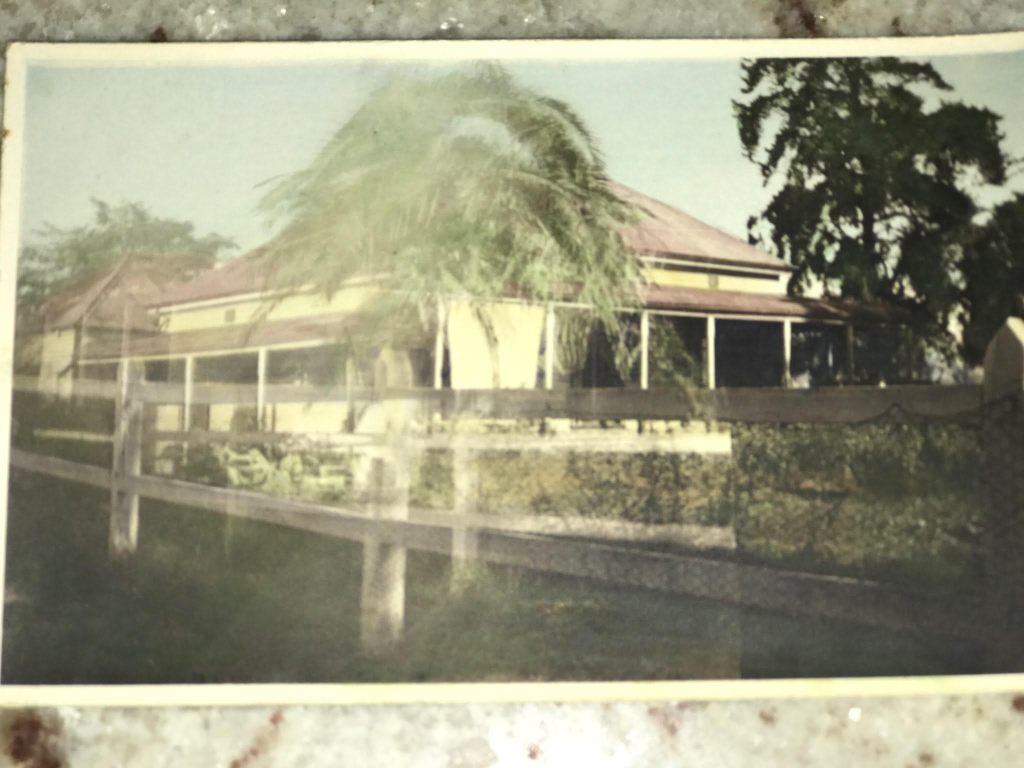
Figure 67: Courtesy of Daniel Shaw
It’s brilliant to see it. Daniel also pointed out in his email that the tree above looks like one of the sentinels still standing there in the photo he took. I bet that was the start of the long driveway down to the Sydney Road.
I hope you can join me for Part Two, in the not-too-distant future, when the Macveans and Shaws will take up the mantle for Rooksdale in the next chapters of its history.

Finally caught up to you – fasinating to say the least.
Love you – AJ
Sent: Sunday, October 05, 2025 at 1:45 AM
LikeLike
Hey AJ, thanks so much for taking the time to read the post and for letting me know. I’m glad you found it fascinating. John x
LikeLike